|
THANKS to Steve Martinez, Gary Barnett, & Glen Coddington for most of the photos!
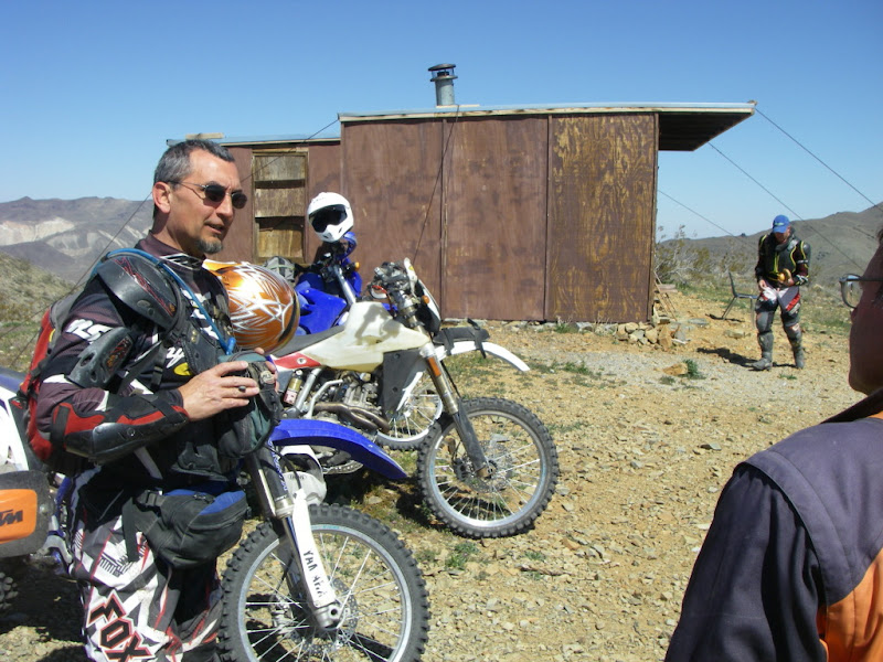
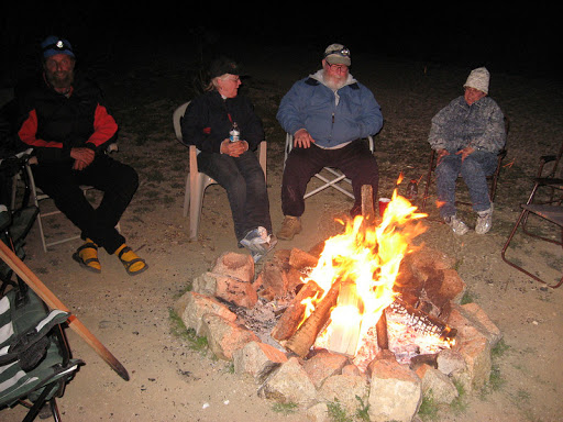
Thursday - I got to Cal. City about 5PM and stopped at the Ace Hardware for firewood & top off the ice chests. As I was passing Borax Bill Park on Twenty-Mule Team Parkway, I noticed a guy in front of a white Ford truck with a dirtbike & a trailer waving at me. Hmmm... who could that be? OH! It was Steve Martinez (Stinez-ADVrider)! I whipped my truck & trailer in and said Hi! He & Lois were just getting in also and stopped to check on permits. Apparently permits are a weekends & holidays thing. It should be officially noted in the Northstars annals that Catfish was the FIRST one to park at camp. And he had HIS dirtbike too! While we were setting up camp, Mitch (buttugly-ADV) drove up & introduced himself. Steve had a good fire going by o-dark-thirty as we settled in with cocktails & attitude adjustments. Over the next couple of hours Rich (TwoWheelsGood-ADV), Gary from Seattle, and Earl & Lee all pulled in.
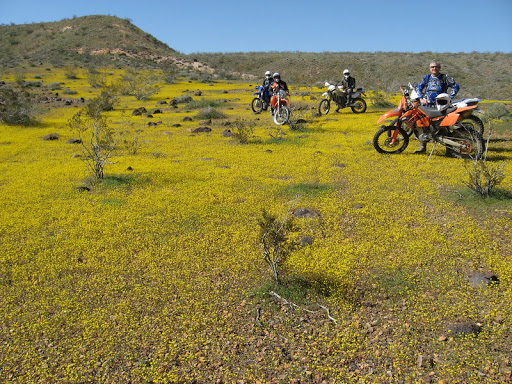
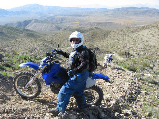
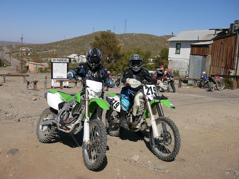
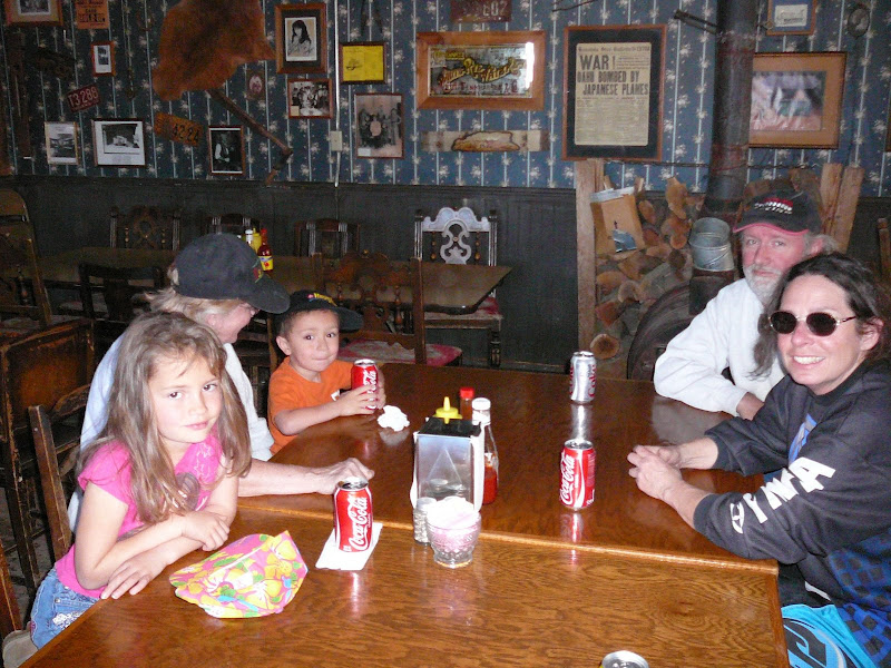
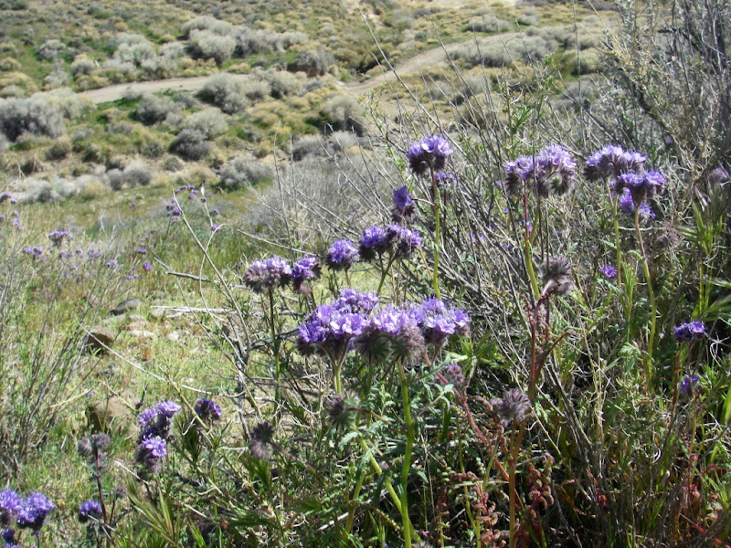
Friday morning was cool and gorgeous. Earl dropped off the Spring-Edition Monkey Brains (with a green St.Patricks-Day cookie!) he had just pulled from the oven. Mmmm-MMM!!! Jason (Odin69-ADV) was moteling in Mojave & would be out to camp about 9AM. Ken (kkug-ADV) pulled in with his trailer. Apparently he arrived late Thursday night after our fire was out & couldn't find us in the dark. We discussed the ride and decided to do an easy one through the Rand Mountains to Randsburg for lunch & back. Maybe a few diversions if folks were up for it. We gathered at the top of the hill next to water tank #3, and headed cross-country to water tank # 5 (north of Galileo Hill). That's the FUN part about camping in Cal. City; most of it is OPEN riding area. Next was Ant Hill and then follow-the-leader to R43 & R20 in the Rand Mountains. No fighter jets were sparring overhead on Friday, but there was a majestic B2 bomber with a fighter escort circling over us many times. R20 is a fast & fun trail through the Rands, but its been shortened by 1/3 its length by the new fences & mines in the area. Grrr... We did R77, R22, & R85 to R30. It was a surprise to see that R22 didn't legally go east of R85 anymore. :-( We wandered back to R16 and R10 into Randsburg from the south. The Whitehouse Saloon & the General Store were both open. I prefer the Soda Fountain at the General Store because they have a great meatloaf sandwich, and can mix up a Real(tm) Chocolate Malt! Not to mention the latest "Friends of Jawbone" area maps on the counter. Mmmm... the meat-loaf was hot out of the oven! After lunch we headed south again and did all of the ridge-top trails to the communications tower. Then cross-country to the old wood-framed mine next to the power-line road. Next was cross-country to the Group B Hills, and then to the old concrete bunker further south. Took a break & enjoyed the views of the mountains. Some of my favorite trails in the Cal. City area are those that head west from the bunker towards camp. Great flowing roller coasts across the hills and singletrack following the ridge lines. A lot of the desert was still green, with yellow & purple wild flowers at elevation. Heaven! The odometer showed 65 miles when we got back to camp. Wendy, Bruce, Sharon, Jamey, Daniel, & Ossa (the man-eating German Sheppard) arrived that afternoon. Cocktails, dinner, & BS around a big fire were the order of the evening.
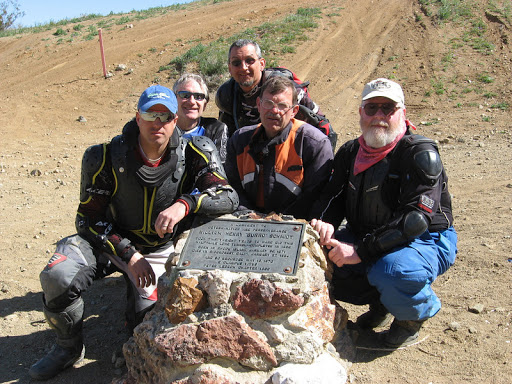
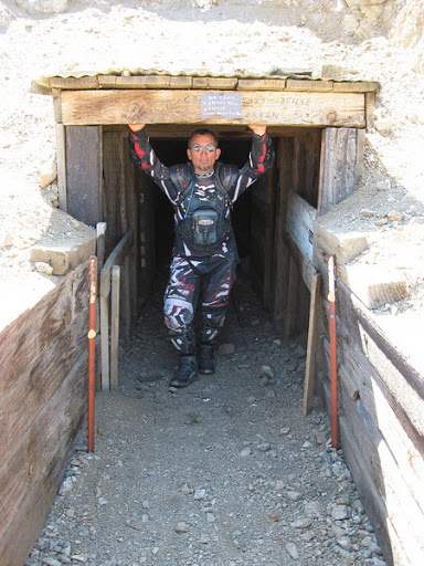
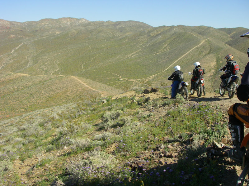
Saturday morning was cool and gorgeous again! Earl dropped off some Monkey Brains again! Mmmm!!! Dale (ZenMoto-ADV) arrived. Next came Bill Glodfelty with 4 of his So.Cal buddies. They were heading to Burro Schmidt's Tunnel in the El Pasos. The rest of us (Catfish, Steve, Mitch, Jason, Rich, Ken, Dale, Wendy, & Gary) were headed east to the Fremont Mountains & the Husky Motorcycle Memorial. First came some cross country slaloming through the pucker bushes and then the fun trails to the bunker. Next was the power line road, east on Fremont Peak Road, and NE to the top of the ridge north of the Fremonts. This is where we split into two groups, so the more advanced riders could run the technical singletrack in the Fremonts, and the others could take the easier roads around them. Mitch, Jason, & Wendy had a FOJ map decided to take the B route south of the Fremonts. As they headed south, we started climbing the singletrack up the ridge lines towards Fremont Peak.
We took a break at the Monarch-Rand Mine and enjoyed the views. Next was more singletrack moving south & then east around the mountains.
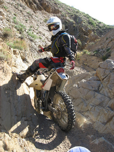
We were following a track I made on my GPS of trails we had run in the past. When we reached the point of turning down from the singletrack to a wash, I noticed MORE singletrack continuing up the ridge! Well, we couldn't pass that up! It was sweet & tight towards the end. Several sections has us walking over the boulders as the bikes just barely fit between them with the pegs folded up. See Dale's video for a view of this section. We dropped into the last wash and headed east towards our rendezvous with the other group. We go to the main north-south road and there was no signs of the other group. Looking to the north, we couldn't see anyone. Our next leg was to the south and the other group may have gotten to the road further south than we did. I felt pretty sure that if we were going to find them, they were south. <clue foreboding soundtrack> We rode past many trails from the west, but no signs of them. When we got to the next left turn to the east, we stopped and discussed our dilemma. I felt pretty certain they had wandered off in *some* direction, but there was no way of knowing which way. Since we were so far behind them time-wise, we figured they didn't wait for us and continued elsewhere. We continued up towards Bird Spring and the Moto Memorial for our lunch break. The last section to the memorial is really getting whooped out.
After the memorial we headed west & then south on a trail I had seen on Google Earth that would lead us back down to the road to Bird Spring. This trail was fun and went through an old mining area with a number of tailings piles to play on. Almost no whoops anywhere! We took the southern loop around the Fremonts to Fremont Peak Road and then west towards California City. We split up after crossing 395 into different groups going cross country back to camp. Wendy, Mitch, & Jason were not back yet when we pulled in, so we had some explainin' to do. Bruce & Jamey wanted to know what we had done with Wendy. That was simple, we abandoned her in the desert with two strange men she'd never met before! Within the hour all three of them came riding into camp with a great adventure story of their own! Libations, dinner, & many great stories by the fire.
Sunday morning was the usual! We were heading into the El Paso Mountains (the next mountains to the north of the Rand Mountains) today to visit Burro Schmidt's Tunnel and explore some cool singletrack. We rode north to Ant Hill and then R43 across the Rands. As see approached the El Pasos, we headed west to Mesquite Canyon Road. This road was fast & easy. We continued west to the tunnel.
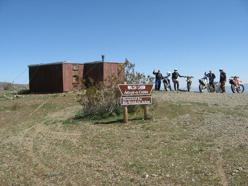
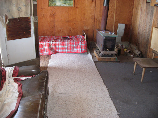
Next we headed up singletrack to the top of the mountains between the tunnel & Mequite Canyon. One hillclimb was long and steep, but we all eventually made it up. We were headed towards what looked like a cabin at the peak in Google Earth. Then there it was!
We took the wash down the cabin and it was obvious that this was the route that the jeeps & trucks would take to get up there. We wandered around many EP roads getting up to Sheep Springs for our lunch break. Afterwards we headed south-east up the singletrack on the next ridgeline. We then rode many trails towards the mountain peaks to the south.
The trail above stopped our forward progress, so we headed back the way we came about 4PM and looked for an easy way out.
We wandered back up to trail EP15 and then down Goler Gulch out of the mountains. Then south across the Rands and back to camp. Another great ride! Wendy & Glen did the ride to Randsburg and back on Sunday. Bruce, Sharon, Jamey, & Daniel tookthe truck to town to join them for lunch at the Whitehouse Saloon.
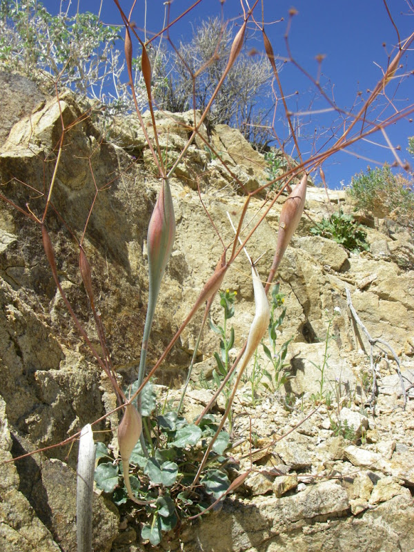
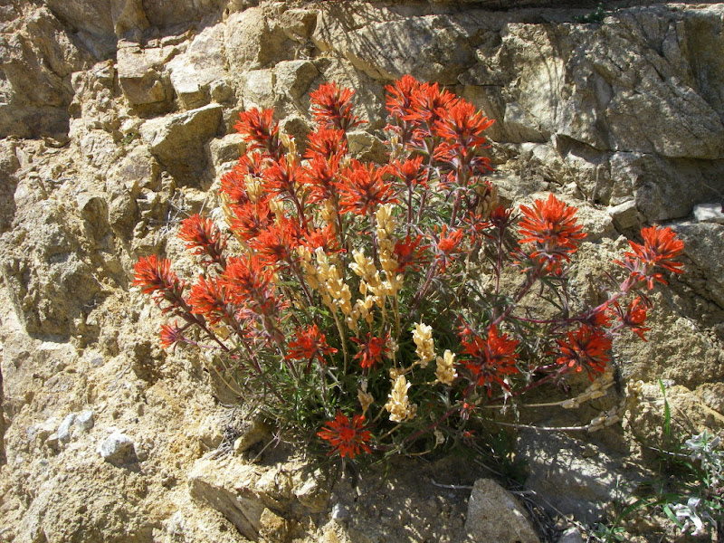
Monday morning was beautiful as Gary & I watched most everyone still in camp packing up for the drive home. But not us. We were heading to Jawbone Canyon for a long dual-sport loop into the Piute Mountains this morning. We took the new CC10 trail towards Jawbone. Stopped at the store to top off the fuel. Next we climbed the hills south of Jawbone to get to the upper aqueduct road. As we climbed in elevation the flowers came into view.
Jawbone Canyon was pretty much empty on this Monday morning. I think we counted 6 bikes. The big hillclimbs looked impressive. We continued up the canyon out of the open riding area onto the county road. This was FAST and fun! It was also amazing how many CLOSED trails are along this road. We crossed Hoffman Summit (4900 ft.), the 4000-ft. Kelso Valley, and started up into the Piute Mountains.
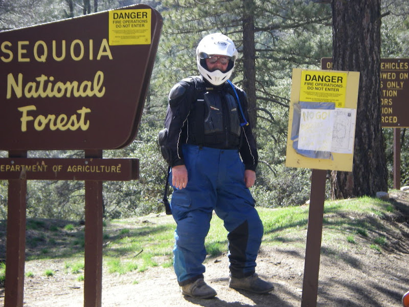
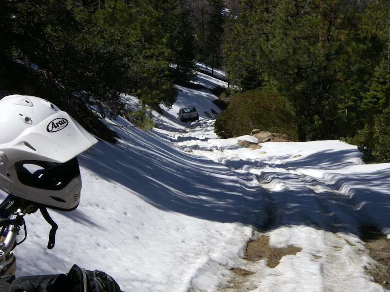
As we entered the Sequoia National Forest, we stopped to look at the many signs. The "DANGER - Fire Operations ..." signs were not dated. The hand-written "NO GO ..." sign said there was a large boulder blocking the road ahead. We giggled like little school girls as we continued up the cool switchbacks. As we crested a hill on its NE side (heading N) we started seeing snow banks in the shaded areas. Several patches were minor.
The abandoned Jeep Cherokee was stuck in the snow. We feared going down the hill would get us to where we would be stuck, so we stopped for lunch. A beautiful day in the mountains! We wandered back down to the canyon and took some different trails back to the open area. Stopped at the store for an ice cream & cell phone coverage, and then back to camp. We had just enough wood left for one last fire after dinner. Tuesday we packed up and headed home. What a GREAT 4 days of riding! THANKS everyone for making this a FUN trip! Catfish ... |